FROM THE DOCUMENT (posted on the Bradford Planning Portal – 25 May 2018 TREE PLAN NO SHADOW which (actually) shows the tree numbers referred to in the revised document: 27 Jul 2018 Supporting Information ARB ASSESSMENT
The above document does not use the same numbering system for trees as the Bradford map detailing the trees with associated TPOs (Tree Preservation Orders) and the following is true
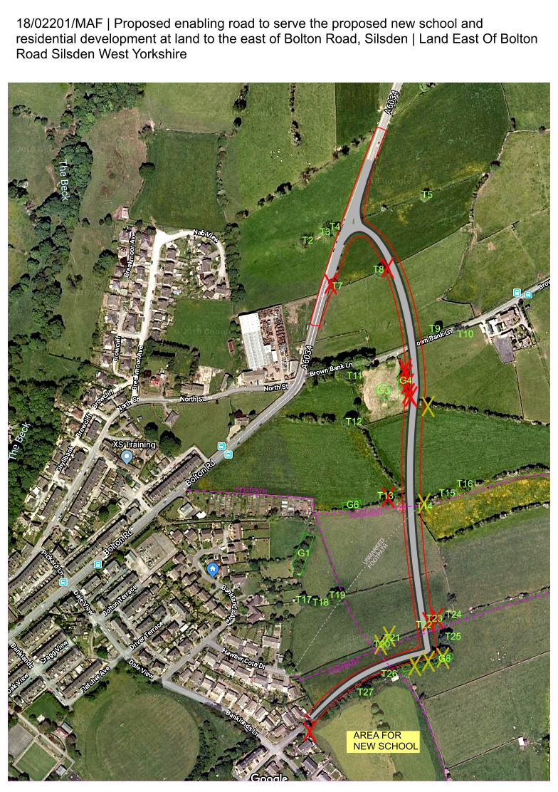
Trees require to be felled X for the proposed enabling road:
BRADFORD TPO ASSIGNMENT
.
T8
G4
G4
G4
T13
T22
School entrance
T7
G4
G4
T23
G4
G4
G4
The supporting document
(ARB ASSESSMENT)
T17
T27
T30
T32
T37
T59
T55
T21
T25
T26
T58
T28
T29
T31
The following may have roots compromised during the building process X and may consequently die.
T14
T21
T20
To the east of G4
G8
T44
T60
T61
T49
G8
There are 14 trees on the list which will require to be felled and 7 more trees which may die as a consequence of this project. These are magnificent mature oak, sycamore and ash trees which have TPOs allocated to them. They are the habitat of many birds, bats and other wildlife.
If the road is extended to the south (phase II) then the group of trees marked as G8 will be felled.
The road compromises/cuts off 3 well-used footpaths.
Is this road required?
Just over 640 (of the 1200 dwellings to be built in Silsden) have already been built. There are 300 currently being constructed, and another 210 which have outline planning permission – that’s about 1150 dwellings so far and this is before any houses are even thought about on Banklands – the land east of Bolton Road.
There is brown-field land at Riverside which should be used first.
The number of houses required is set to be reduced (2020) by Government review ie the Banklands land is NOT required for housing.
Any housing built on this land will contribute to the traffic gridlock, conditions which already exist in Silsden.
As a school access route, this road does not fit the bill. It is out of the way for parents of children attending the school.


")
")
